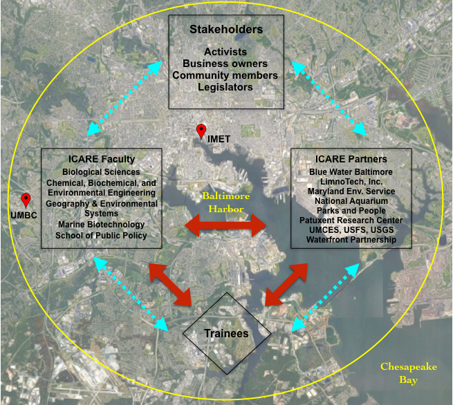
Conceptual map of the ICARE-NRT overlaid on a satellite map of Baltimore Harbor, indicating locations of UMBC and the Institute for Marine & Environmental Technology (IMET). Trainees formed co-advised research teams with ICARE faculty and partners (red arrows). Trainees, co-advisors, and relevant stakeholders participated in expert-facilitated, interdisciplinary training and research development sessions (“CoNavigator,” blue arrows). Research needed to inform policy-based solutions in Baltimore Harbor examined interactions among multiple biophysical (marine, freshwater, and terrestrial ecosystems) and socioeconomic factors.